Sencrop meteo station integration
Stacje meteorologiczne wyprodukowane przez firmę Sencrop możesz zintegrować w SatAgro. W tej instrukcji znajdziesz opis, jak połączyć stacje Sencrop z twoim kontem w SatAgro.

Stacje meteorologiczne wyprodukowane przez firmę Sencrop możesz zintegrować w SatAgro. W tej instrukcji znajdziesz opis, jak połączyć stacje Sencrop z twoim kontem w SatAgro.
The SatAgro application allows you to integrate weather data from Cordulus stations.
This enables more accurate monitoring of weather conditions on your farm. This guide provides step-by-step instructions on how to connect a Cordulus station to your SatAgro account.
The SatAgro application allows you to integrate weather data from Davis stations, enabling more accurate monitoring of conditions on your farm. Connecting a Davis station to your SatAgro account involves just a few simple steps.
When you decide to download precision treatment files for use in the field or in different software, the system will ask you to choose a file format: shp – also called a Shapefile, ESRI shapefile, .shp. You can edit this file yourself in GIS software – for experienced users. ISOXML – file format used in ISOBUS compatible machinery. anl – file format compatible with AGROCOM MAP software csv – basic file format for tabular data, accessible in e.g. Excel kml – this can be used in Google Earth terminal’s format – CHOOSE THIS OPTION if you plan to use the…
You can export the satellite and weather data that SatAgro collects for your field for use outside the app. Go to the field sheet of the field you are interested in (click: Fields > FieldName). In the top right of the field sheet, next to the field name click on the down arrow symbol. SatAgro will prepare a zip file containing satellite images and time series for your field in formats that should be compatible with most common spatial or spreadsheet software.
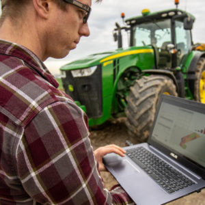
SatAgro is integrated as a connection to the John Deere Operations Center. This allows for streamlining various operations between the two platforms including: Thanks to the integration with John Deere Operations Center we can share information about your account, equipment and fields to make it easier to work between the two applications. Sending prescription maps to the Operations Center To be able to send our maps to the Operations Center or a specific terminal, during the creation of a fertiliser or crop protection treatment you only need to choose a John Deere terminal. Once the prescription has been created, a…
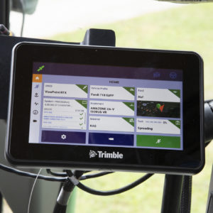
The SatAgro platform can integrate with Trimble’s cloud tools. This allows your device information to be shared with SatAgro. Thanks to the integration with Trimble Connected Farm you can send prescription maps created in SatAgro directly to your Trimble terminal and work comfortably with the information available on both platforms.
The SatAgro platform is integrated with cloud services offered by AGCO on the FUSE Smart Farming portal. This allows you…
 Platform