07/04/2023
Mozambique is considered one of the most vulnerable countries to climate change. Extreme events such as floods and prolonged droughts threaten the food security and economic stability of the population, especially in rural areas.
The main objective of the GERHARA project is to develop innovative strategies focused on improving water management by the Administrações Regionais de Águas de Moçambique (ARAs) and thereby enhancing resilience to climate change in Mozambique. A particular emphasis has been placed on the agricultural sector, where multiple initiatives have been undertaken to address challenges related to water access and water resources management in the country. The leadership of the GERHARA project has been entrusted to the Spanish company iCarto, with funding provided by Cooperación Galega.
Work performed by SatAgro
Throughout the project we have used remote sensing techniques and advanced segmentation tools, contributing to obtain crucial data to better understand and manage water resources in the region managed by the ARA-Sul IP. The tasks carried out in SatAgro has been divided into:
- the process of crop classification of the entire area managed by ARA-Sul (in total more than 175,000 km² (~68000 mi²)) located in southern Mozambique;
- the delimitation of crop fields boundaries in order to detect medium and large farms to be included in the water use licensing system managed by ARA Sul IP; and
- preparing all the necessary documentation and tools to be able to reproduce the process in-situ by ARA staff.
Crop area classification
Crop classification by remote sensing has been an essential component to analyze the distribution and composition of crops in the study area. For this purpose, we have used data from satellites such as Sentinel-2 and Planet, which provide us with high resolution and revisit frequency images.
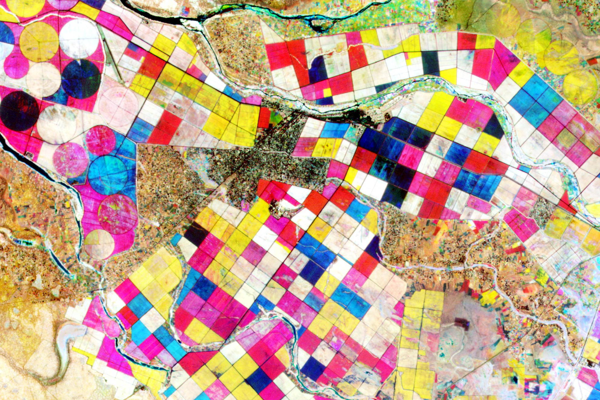
It should be mentioned that Planet’s commercial data have been provided thanks to Norway’s International Climate & Forests Initiative (NICFI) program through which we have obtained access to high resolution monthly mosaics (~4.7m/pixel) with RGB images as well as near-infrared band data.
These images have allowed us to obtain detailed information on the spectral characteristics of different crops, which in turn has helped us to distinguish different types of crops present in the region. Using different tools and algorithms specialized in the classification of land use types from satellite images, we have been able to efficiently process and analyze large volumes of data, extracting valuable information about cropping patterns.
Using supervised and unsupervised classification techniques, we have been able to map and quantify the spatial distribution of crops, providing a solid basis for informed decision making in water management and further agricultural planning.
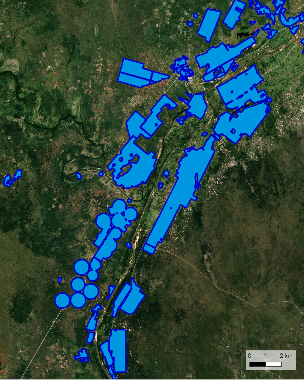
Boundary detection and crop field segmentation
Once the crop classification was obtained, the next step was the detection of field boundaries using advanced segmentation methods. For this purpose we have used different neural networks such as DexiNed and Segment Anything (SAM), which are able to accurately and efficiently identify and delineate the boundaries of agricultural fields after being trained to detect this type of information.
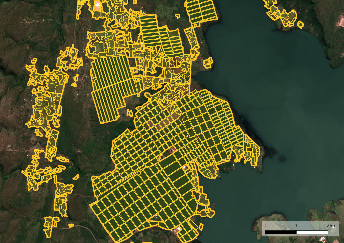
These segmentation techniques have provided us with fundamental information on the structure and extent of the fields, which is essential for understanding and properly managing water resources in the region.
Other activities within the framework of the project
The GERHARA project addresses the different challenges by implementing a series of specific measures related to water use and agriculture focusing its actions in different key areas:
- Institutional strengthening: Work is being done to improve the capacity of the Administrações Regionais de Águas de Moçambique (ARAs), the entities responsible for water resource management and planning. This involves greater internal coordination, an increase in technical staff and capacity building to meet the challenges posed by climate change and droughts. In addition, the implementation of gender policies to promote equality in decision making is promoted.
- Water balance management: GERHARA focuses on improving the management of water supply and demand through the application of accurate models and systems to estimate actual water demand and availability. This will allow for more effective planning and better decision making regarding water use.
- Equity in water distribution: The project focuses on addressing inequality in water distribution. It seeks to prioritize domestic and community water use over commercial use by large farms and industries, in compliance with Mozambique’s water law.
Conclusion
The GERHARA project is another major regional-scale project that we have successfully completed at SatAgro. By addressing the challenges of water access, water resources management and climate change, it is expected to improve water availability for the population and promote more environmentally friendly farming practices in the agricultural sector. It represents a significant step towards sustainable agriculture in Mozambique.
 Platforma